Sado rewards travelers who refuse to hurry. Reaching it means a proper sea crossing, and the reward on the far side is a world that feels genuinely apart — hushed harbors, cedar-dark temple grounds, a coast that can turn wild without warning. Give the island two days and it will give you back a slower pulse.
An island of two mountain ranges
Sado lies northwest of the old province of Echigo, out in the Japan Sea, under the administration of Niigata Prefecture. Seen from the water, the island resolves into two parallel mountain ranges — Osado to the north, Kosado to the south — joined by a low, fertile plain called Kuninaka, so that from certain angles the whole island takes the shape of a written character. Kinpoku-san, the crown of the Osado range, is the island's highest peak; from its summit the gazetteer's writers looked out on the Japan Sea to east and west at once, down over the rice country of the Kokufu river, and — on clear days — across the water to the mountains of Echigo and Noto. The Kuninaka plain between the ranges is the island's granary, a long quilt of irrigated fields with the port town of Ebisu at its northeastern end and a string of villages along Mano bay to the southwest.
Ogi, a harbor split in two
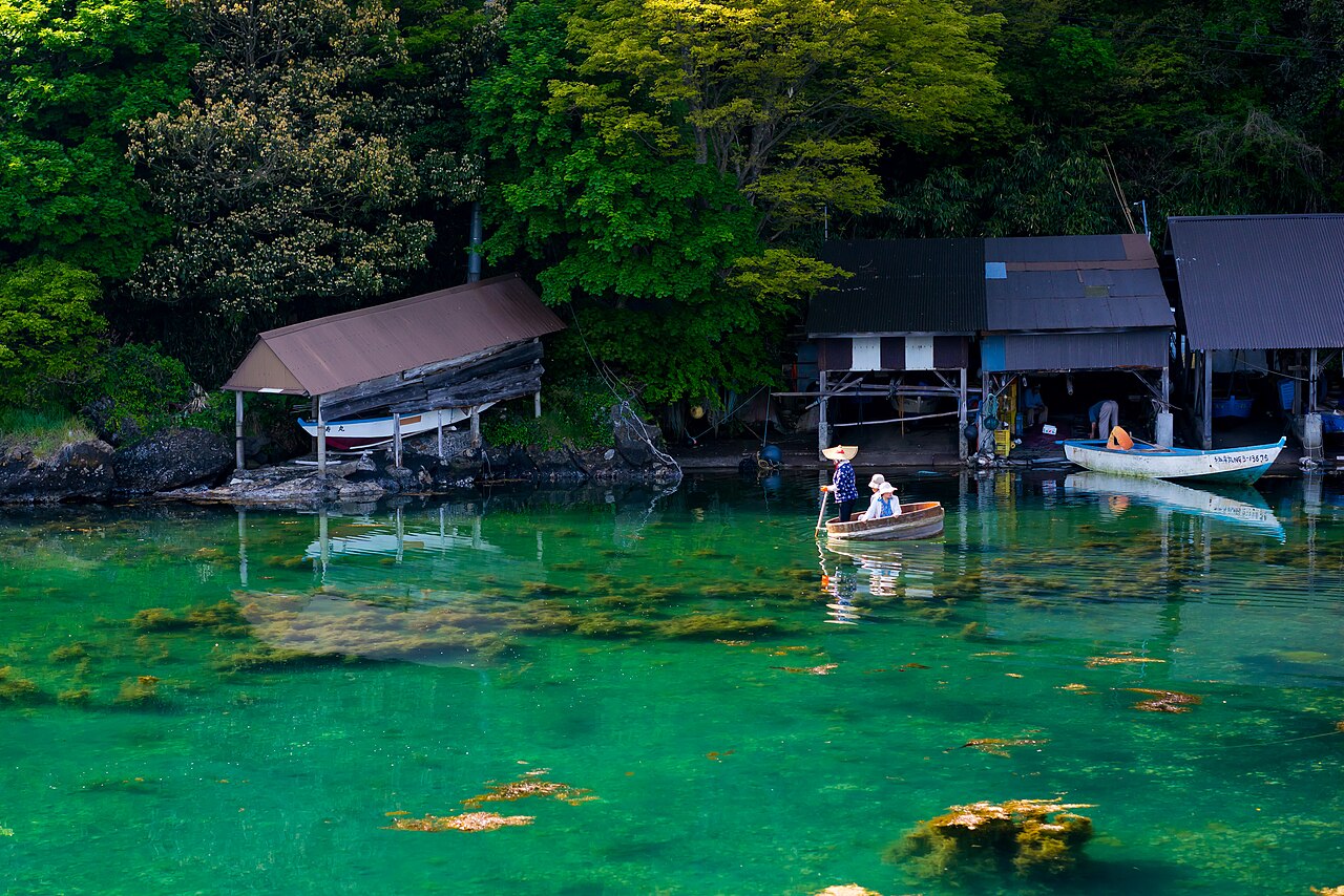
Ogi sits at the island's southwestern tip, facing south. A small cape divides its bay into an inner and an outer harbor, and in the age of sail the sheltered inner water was thick with ships: Ogi was Sado's trading port for the crossing to Echigo, with steamers running to Izumozaki, and a refuge for vessels working the coast between Naoetsu and Niigata. The town still keeps that maritime scale — low, close-set, arranged around its water. In the rocky coves east of the harbor, round wooden tarai-bune, the island's famous tub boats, cross the clear green shallows past weathered boat sheds, and the scene has changed less than you would guess.
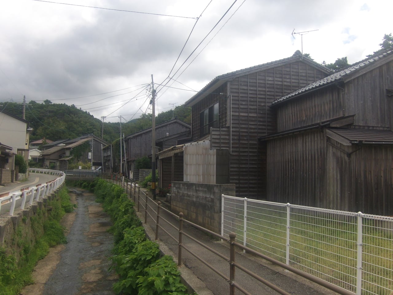
At the western edge of town stands Anryu-ji, a temple of the Nichiren school. Tradition holds that this is where a monk came ashore carrying Nichiren's letter of pardon, and among the temple's treasures is a Lotus Sutra copied in gold ink on deep blue paper during China's Yuan dynasty. A little along the shore in Shukunegi, the temple Shoko-ji is said to mark the landing place of a wandering holy man — this southern corner of the island collects arrival stories the way other places collect farewells.
Old temples and the first shrine
North of Ogi, at the hamlet of Kobiei, the monastery of Rengebu-ji spreads across a hillside under old trees. The hill behind it is called Hachiyo-zan, likened to the eight-petaled lotus of the mandala, and the grounds have a dim, secluded gravity — hall after hall, a two-storied pagoda, a mountain gate, all wrapped in deep shade. The temple traces its founding to Kukai himself, and the shogunate later granted it lands under vermilion seal.
Northeast of Ogi, where the Hamochi river comes down through rice fields, stands Watatsu-jinja, reckoned first among the province's ancient shrines — the ichinomiya of Sado. Wooded ridges ring the shrine on every side; the river runs in front of it, and across the valley a pair of peaks nicknamed Imose-yama face each other like companions. The gazetteer counted this among the island's finest scenes, at its best in spring blossom and autumn leaves, and by long custom the shrine's great festival falls on the twenty-third of April.
An exiled emperor's island
Sado's history is written in exiles. In the early thirteenth century, after a failed strike against the Kamakura regents, the retired emperor Juntoku was sent across this water. He lived more than two decades on the island and died at the Kuroki palace site without seeing the capital again; his first landfall is remembered at Koigaura on Mano bay. His mausoleum stands above Mano — a square of stone walls enclosing green pines and a pair of stone lanterns, long tended by the temple below. The road along Mano bay threads the shoreline with the scenery shifting at every bend, the same inlet where the emperor, in a famous poem, grieved that he would waste away by the waters of Mano.
Nearby stands Myosen-ji, founded when one of Juntoku's loyal guardsmen, who had followed him into exile, turned his own house into a temple after the emperor's death. In its grounds is the grave of the courtier Hino Suketomo, executed on Sado after another failed plot against the warrior government — a modest five-ringed stone. An old pine in the temple precincts is said to have hidden his young son, who slipped into the magistrate's compound by night to avenge his father, a tale told at length in the Taiheiki. Nichiren, too, was banished here: Konpon-ji at Tsukahara marks the site of his exile hut, its halls said to outshine even Myosen-ji in workmanship.
Aikawa and the mountain of gold
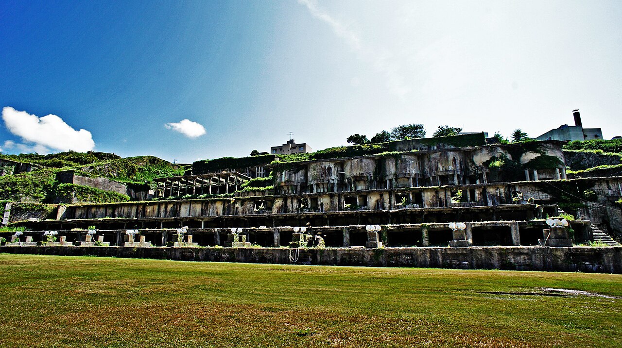
On the west coast, Aikawa was for centuries the island's metropolis. In the Meiji era it counted roughly twelve thousand people, held the prefectural offices, courts and constabulary of the island, and owed its whole busy existence to one thing: the mine in the valley northeast of town. Under the Tokugawa shoguns this was the greatest gold producer in Japan, worked continuously from the early seventeenth century, its old shafts so numerous that people called them the "eight hundred and eight pits." The streets below prospered on the mountain's back — orderly, commercial, full of miners and mine officials.
The mine also gave Aikawa a craft of its own: mumyoi ware, a russet pottery turned from the ochre clay of the workings, prized for its quality though never made in large pieces. And above the town, against a wooded slope, stands the shrine the miners called Yama-no-kami, the mountain deity, founded in the early Tokugawa years by the mine magistrate Okubo Nagayasu. Miners once gathered here in formal dress for the annual mine festival, and from the shrine grounds, between the pines, the gazetteer's writers watched white sails cross the water toward Kasuga cape.
Kamo lake and the ferry town
Ryotsu, on the island's northeastern shoulder, is Sado's front door and the largest port on its eastern coast — in the gazetteer's day a double town of Ebisu and Minato that between them kept the island supplied through the winter months. Directly behind the town spreads Kamo-ko, a brackish lagoon separated from the sea by the strip of streets, ringed on its other three sides by green mountains whose reflections lie on the water in fine weather. For the best view of the lake, the old writers pointed to Gon-misaki on the eastern shore; off the western bank floats a tiny island with a small shrine. A century ago the lakeside eateries served carp and catfish from the lagoon, and Ebisu and Minato each held a market once a month, farmers and fishermen from the surrounding villages filling the road with their goods.
The wild outer coast
North and west of Aikawa runs the Sotokaifu, the outer coast — a long sweep of shoreline where the mountains drop straight into the sea. Along the stretch between Kashi-Ogawa and Negai there is almost no level ground; red pines grip the offshore rocks in formations the islanders call shimadai, and when the swell rises the surf sounds like thunder, the whitecaps known locally as "rabbits." The gazetteer's writers thought the whole coast looked like a Chinese ink painting, and the comparison still lands. The shoreline folds into coves and islets studded with strangely shaped rocks that carry old names, and the caves multiply as you go north, the rough water making ever grander scenery. Both of Sado's coasts have long been known as rich fishing grounds for abalone, squid and mackerel.
One caution travels well across the century: the gazetteer already warned that the shore road here was rough going. This is still the part of the island to plan most carefully — settle your route and check conditions before committing to it.
Getting there
From Tokyo, the Shinkansen reaches Niigata in about ninety minutes. From Niigata port, the car ferry crosses to Ryotsu in two and a half hours, while the jetfoil makes the same crossing in just over an hour. There is also a southern approach: the car ferry from Naoetsu to Ogi takes two hours and forty minutes, landing you at the tub-boat harbor rather than the lake town. On the island, allow real driving time — the gold mine is about an hour by car from Ryotsu, roughly eighty minutes from Ogi, and about ninety minutes if you take the Osado Skyline route over the ridge.
New to rural buses and one-man trains? See how to ride them, step by step.
Where to stay
Disclosure: This post may contain affiliate links. If you book through them, we may earn a commission at no extra cost to you.
A slower shape for two days
Arrive at Ryotsu and spend the first evening walking the strip between the lake and the sea. Give the second day to Aikawa and the mine valley, with the Yama-no-kami shrine and a look at mumyoi pottery, and keep the outer coast for whatever weather allows. On the last day, cross the island to Ogi for the tub boats, Shukunegi and the temples of the southern hills, and sail out from the southern port instead of the way you came. If you are building a longer, quieter route through Japan, you can browse quiet trips and tours for more ideas.
Ferries, roads and festival days on an island like this shift with season and sea — check official information before visiting.