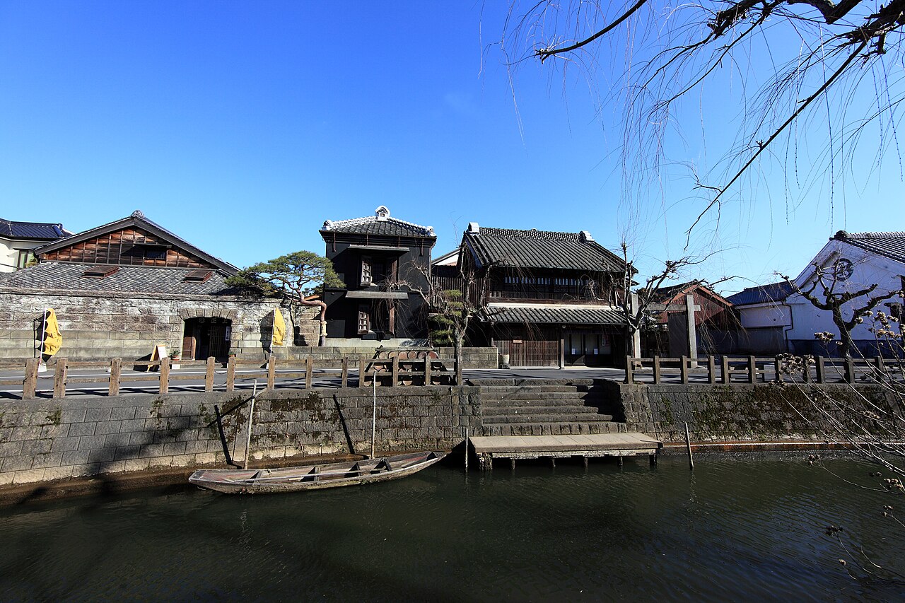
This guide follows one slow day in Sawara, a canal town in Katori, Chiba — the old merchant houses along the Ono River, the museum of the mapmaker Ino Tadataka, the sake streets, and the short road out to Katori Jingu — pairing current rates from the operators' own pages with scenes from Meiji-era records of the Katori district.
Storehouses of dark plaster and timber still face each other across the Ono River, and wooden boats still slip between them. The scale is small, the pace is gentle, and a single unhurried day covers the water, the mapmaker and the great shrine beyond the town.
Getting to Sawara
The simplest way in from the capital is the highway coach, which runs out of Tokyo and sets passengers down on the north side of Sawara's rail halt. Buy a one-way seat and the town does the rest; everything in this guide lies within an easy walk of the water.
| Highway coach, Tokyo to Sawara | One-way rate |
|---|---|
| Grown-ups | nineteen hundred yen |
| Children | nine hundred and fifty yen |
The pairing of road and river is old. In Meiji-era records the town is described as keeping its rail stop at the northwestern edge of the streets, with a landing for fishing boats at the mouth of the Ono River, so that goods and travellers arrived by land and by water alike.
Two Banks of the Ono River
According to local records, the eastern side of the water was called Honmachi and the western side Shinmachi, with the wooden Toyohashi bridge hanging between the two quarters. Stand on its planks and the geography of the whole town explains itself in a glance.
In the same records the town is described as divided into twenty-seven wards, with about two thousand households inside them — a true market town, not a village with pretensions. Walk it today and the proportions still make sense: shop-houses deep enough to feel urban, streets short enough to cross on foot.
In the old district survey, Sawara is described as the chief town of Katori, the point from which road distances to every corner of the district were measured. That detail is worth carrying through the day, because it explains the confidence of the architecture along both banks.
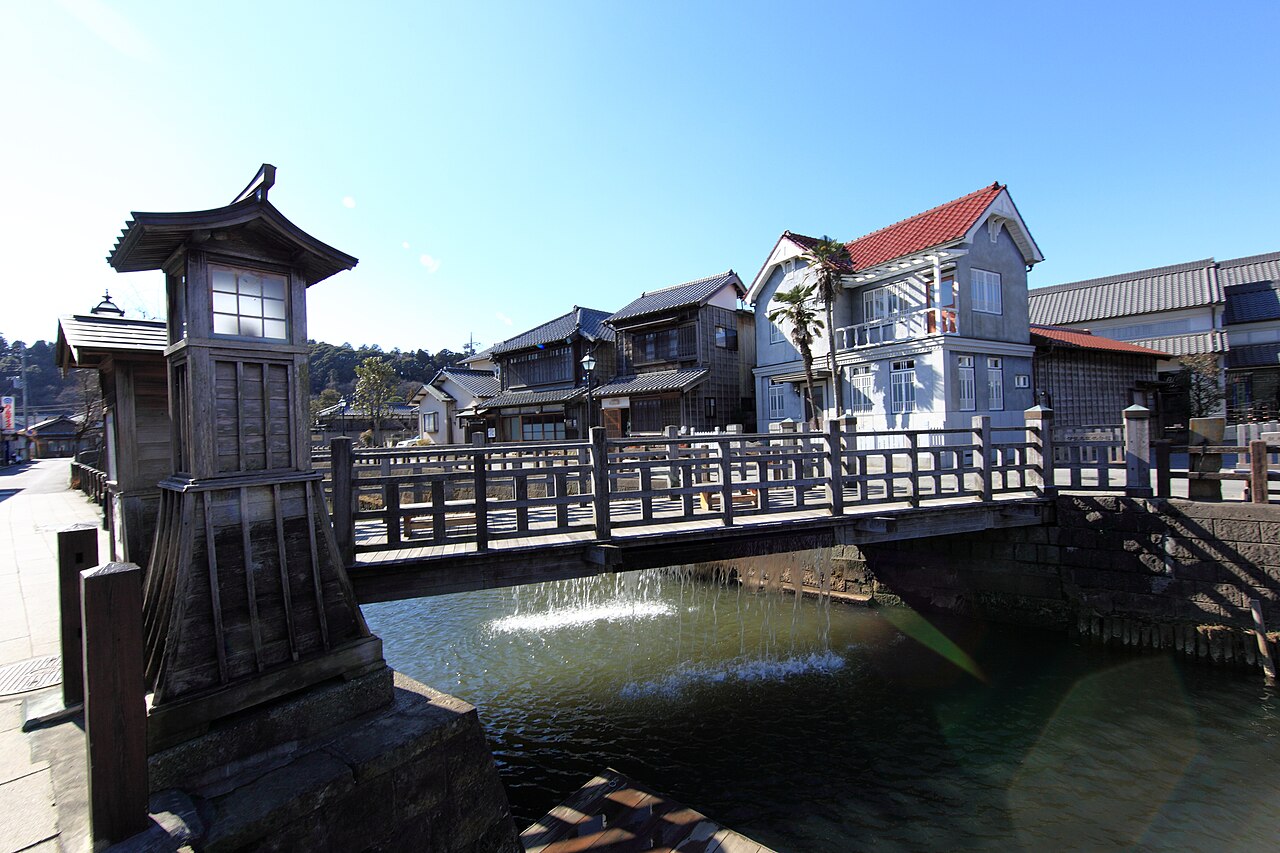
The Town That Measured Japan
Ino Tadataka, the surveyor whose walking maps first drew the true shape of Japan's coastline, ran his family business here before he ever measured a single shoreline. The memorial museum that keeps his memory stands by the Ono River, and its rates are modest for what is inside.
| Ino Tadataka Memorial Museum | Individual rate |
|---|---|
| Grown-ups | five hundred yen |
| Elementary and junior-high pupils | two hundred and fifty yen |
| Visitors sixty-five and over | four hundred and fifty yen |
| Joint ticket with the festival-float hall, grown-ups | eight hundred yen |
| Joint ticket, elementary and junior-high pupils | three hundred and fifty yen |
The joint ticket pairs the museum with the hall that shelters the town's great festival floats, and the two together fill a slow morning. Opening times shift through the year, so glance at the museum's own listing before you plan the visit, and compare bookable Sawara outings if you want the rest of the day settled early.
Compare options
See partner pricing and availability →
Disclosure: This post may contain affiliate links. If you book through them, we may earn a commission at no extra cost to you.
Sake, Mirin and the Merchant Streets
In the district records, clear sake, sweet mirin and narazuke pickles are described as the goods that made Sawara's name, and brewers of sake and soy sauce are said to have worked across the town. The smell of fermentation was, in plain terms, the smell of prosperity.
By the middle Meiji years the town is described as holding the district office, a police post, a local courthouse, a tax office, the town hall, a post-and-telegraph office, schools of both grades and banks — and, tellingly, a great number of inns. Administration, education and commerce all pooled here.
Before the Tensho era the place is described as a minor village under the Kokubu lords of Yahagi castle, and only after the decline of the Chiba clan did the Ino, Nagasawa and Enjoji families move in, clear the land and gather a town around themselves. One of those family names — Ino — returns later, carrying surveying chains.
The Old Song About Edo
The town's best calling card is a song. An old verse — 御江戸見たけりや佐原へ御坐れ、佐原本町江戸まさり — is said to promise that anyone wanting a look at Edo should simply come to Sawara, whose Honmachi quarter outdoes Edo itself. It is a large boast for a provincial town; the old records themselves do the arguing.
Another verse of unknown authorship is said to sing of a crossroads town reached from all four directions, with a bustle to rival the capital at Kyoto. The poet Fujimori Tenzan left lines in Chinese that are said to picture sails crowding the waterfront and sake fermenting in house after house.
The boasting had a ledger behind it. In the Meiji survey of the district's market towns, Omigawa is described as taking second place behind Sawara, which stood at the head of the district's trade. A ranking conceded in the district's own pages makes the old song sound less like flattery.
Out to Katori Jingu
Katori Jingu, the great shrine of the region, sits close enough to make Sawara its natural front door. In the old records the road between them is described as twenty-eight cho, a little over three kilometres — an easy extension of the day rather than a separate outing.
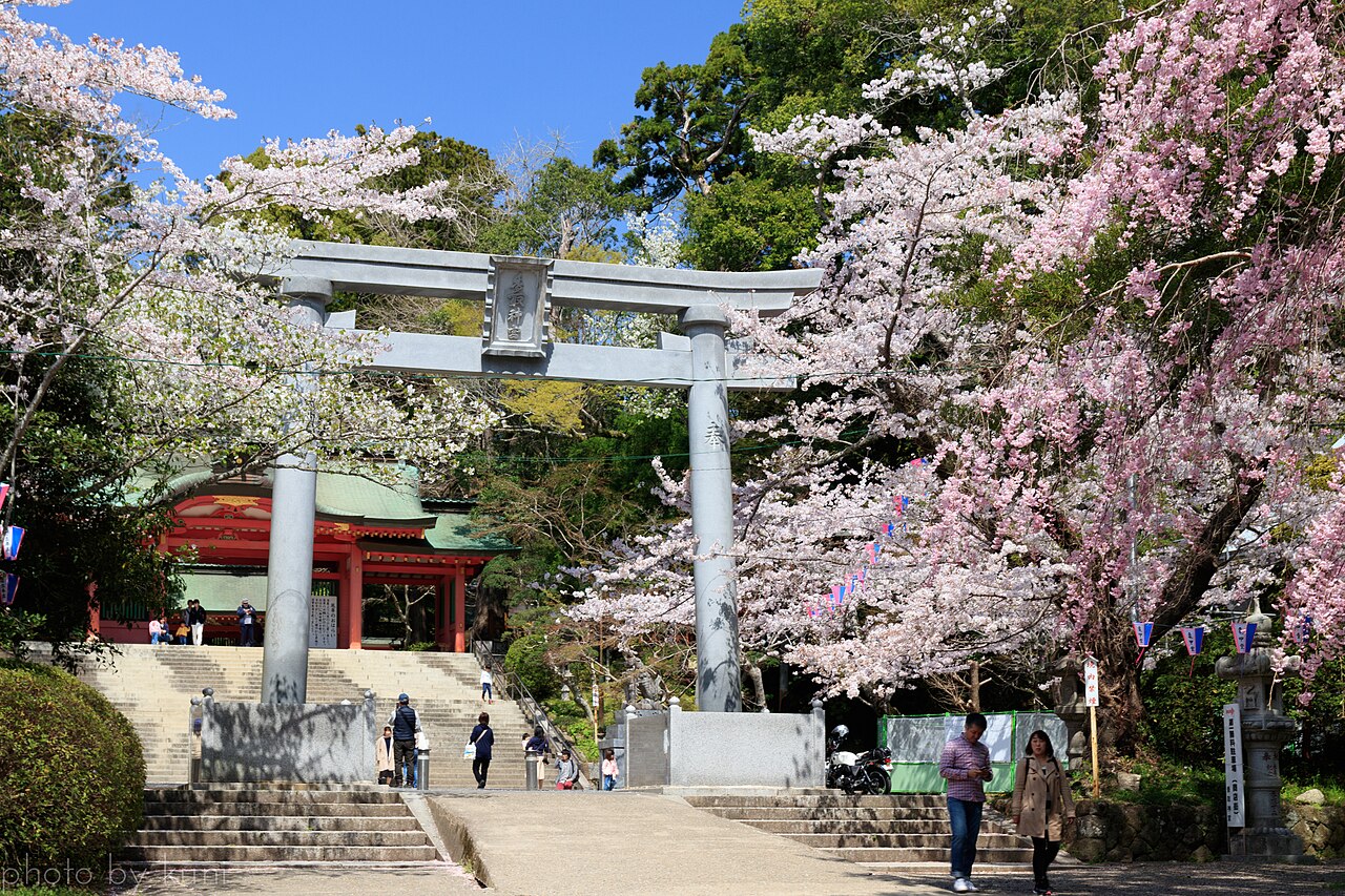
The route even had a name. According to local records, the Jingu road — the Sawara-Niijima way — branched from the Choshi highway and carried pilgrims from Sawara through the villages of Niijima and Tsunomiya to the shrine town of Katori. Much of the pleasure is still in that direction of travel: out of the merchant streets, into shrine forest.
The road owes its comfort to townspeople, not to the state. In the thirty-first and thirty-second years of Meiji, a Sawara resident named Ogura Kyubee is described as leading the petitions to the prefectural seat and raising private money until the pilgrim road to the shrine was rebuilt end to end.
Even the town's name is said to bow toward the shrine: one tradition holds that Sawara began as the place where ritual earthenware for Katori Jingu was shaped — pottery for the gods long before sake for the merchants. It is the kind of etymology that suits a town still organised around its water.
Shaping a Quiet Day
Sawara reads best as a hub. The Meiji road tables are said to place Narita at roughly eight ri and Choshi at a little over ten ri along the old highways — the ri being the old post-road league — with the town sitting square in the middle of the district's traffic.
Three trunk roads are described as running out from the town in the old registers: a branch way toward Narita, the Sawara-Fukuoka road cutting north to south through the heart of the district, and the Sawara-Tako road heading for Tako. A market town, in short, that every road had reasons to visit.
For groups, the mapmaker's museum sharpens its welcome: parties of fifteen or more pay the grown-up rate of four hundred and fifty yen a head. It is the kind of detail that makes Sawara an easy proposal for a club outing or a slow family day away from the capital's crowds.
Shape the day simply — water in the early light, maps at midday, gods after lunch — and browse Sawara day tours and tickets if you would rather have the sequencing handled for you. Rates and times move through the year, so glance at the operators' own pages before you fix the plan.