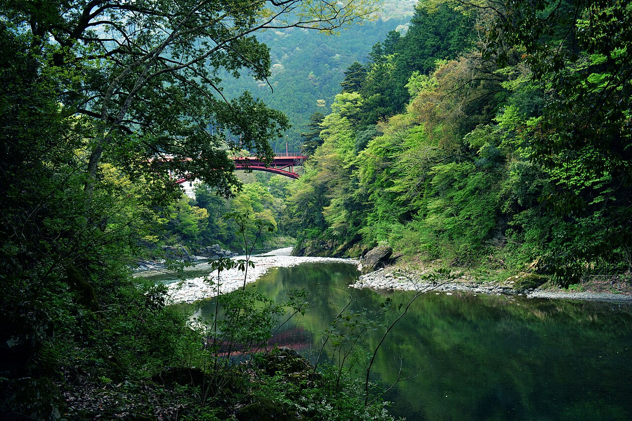
Okutama is the deep end of Tokyo. Stay on the Ome Line past the last commuter suburbs and the train enters real mountain country — gorge walls, cedar forest, a river turning jade below the bridges — while your Suica card still works and the address is still technically the capital. The old town of Hikawa, now Okutama Town, sits where the Nippara River meets the Tama, ringed by the water-source forest that supplies the city's taps, and it makes the wildest car-free day trip Tokyo has: a limestone cave up a side valley, an old highway you can walk to a mountain lake, and valley air that smells of wet stone and cedar.
Getting there
- From Shinjuku, take a JR Chuo Line rapid heading for Ome; depending on the train you may change at Tachikawa or Ome. At Ome the line changes character completely — from commuter railway to mountain railway.
- The final Ome-to-Okutama stretch takes a little over 40 minutes, single track the whole way, curving along the Tama gorge past tiny stations like Sawai and Mitake. Sit on the right side going up for the river views.
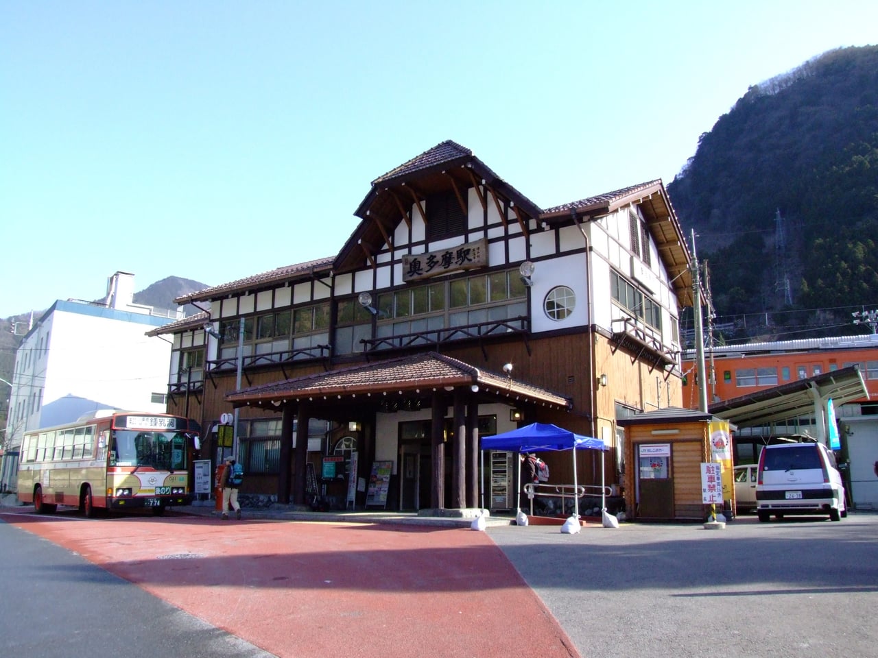
- Okutama Station is the western terminus of the line and of the JR network in Tokyo — IC cards work all the way.
- For the Nippara Limestone Cave, a local Nishitokyo bus runs from the station up the narrow Nippara valley; on busy weekends and holidays buses can terminate short of the cave itself, leaving a further uphill walk along the valley road, so check the stop and the return times at the station before boarding.
New to rural buses and one-man trains? See how to ride them, step by step.
The Nippara Limestone Cave
Up the Nippara valley, where the gorge walls squeeze the road to a single lane, opens the region's one big indoor sight: a limestone cave that local tradition says was discovered by the monk Kobo Daishi, and that served for centuries as a site of mountain worship before it became an attraction. Inside, walkways and stairs wind past flowstone and a vaulted chamber lit in soft colors; the air stays cave-cool even in August, so bring a layer. Admission is 900 yen for adults (high-school age and up), 700 yen for junior-high students, and 600 yen for children; it opens 9:00 to 17:00 from April through November and 9:00 to 16:30 from December through March, with last entry 30 minutes before closing, and closes only over the New Year days (December 30 to January 3). Payment is cash only.
Walk the old highway to the lake
The best half-day on foot here is the Okutama Mukashi-michi, the "old road" — the former Ome Highway that carried packhorses and pilgrims up this valley before the modern route was blasted through. It runs about nine kilometers from Okutama Station to Lake Okutama, and an unhurried walk takes around four hours: mostly gentle lanes and forest track past wayside shrines, suspension footbridges over the gorge, and hamlets clinging to the slope. It ends at the lake behind the great dam that stores Tokyo's drinking water, where buses return you to the station. Walked on a weekday morning, you may meet more monkeys than people.
Where to stay
Disclosure: This post may contain affiliate links. If you book through them, we may earn a commission at no extra cost to you.
A river with legends in its pools
These mountains are old sedimentary rock, carved rather than erupted, which is why the valleys cut so deep and the river pools turn that improbable green. Upstream the Tama takes the local name Tanba River, and its gorge hides pools the old road-users named and storied: one is called the Golden-Ox Pool, after a legend that part of the Takeda clan's war treasury, cast as a golden ox, lies sunk in it; another, the Courtesan's Pool, keeps a sadder tale from the highway days. Kumotori-yama, rising at the head of the watershed, is the highest point in Tokyo, and nearly every trail in the area threads the protected water-source forest — a slow ramble here is literally a walk through the city's water supply.
When to come
Late April into May sweeps the slopes with fresh green and wildflowers; summer is the season for the shaded upper valleys, where primary forest keeps the gorges dim and cool; autumn color peaks in the high valleys around mid-October and reaches the town in early to mid-November. Winter is the secret season — sharp air, bare views into the gorges, and almost nobody on the paths.
How to keep it quiet
- Take the earliest train you can manage. The valley belongs to you until the mid-morning arrivals; by noon on a fine Saturday the station forecourt is all daypacks.
- Autumn-foliage weekends are the one time Okutama genuinely crowds — buses fill and the cave queue grows. Come midweek in that season, or aim for winter instead.
- The cave draws school groups around midday; go first thing or after 14:00.
- On the Mukashi-michi, walking from the station toward the lake puts the sun and the views ahead of you and the crowds behind.
Honest notes
This is real mountain terrain: paths are slippery after rain, phone signal drops in the side valleys, and shops in town close early — buy lunch supplies before you head up the Nippara road. The cave is cash only and closes over the New Year. And the last trains back toward Tokyo leave earlier than city instincts expect; check them on arrival.
The essentials
- Ome to Okutama on the JR Ome Line: a little over 40 minutes; IC cards accepted; from Shinjuku allow a half-day round trip.
- Nippara Limestone Cave: adults 900 yen, junior-high 700 yen, children 600 yen; 9:00–17:00 April–November, 9:00–16:30 December–March, last entry 30 minutes before close; closed December 30–January 3; cash only.
- Okutama Mukashi-michi old road: about 9 km, around 4 hours, station to Lake Okutama.
The neighboring stop down the line has its own quiet world: see our guide to the shrine settlement on Mount Mitake, or compare all our car-free escapes in the quiet day trips from Tokyo roundup.
Compare options and book via our partner links: Okutama hiking, cycling, and rafting day trips on GetYourGuide.