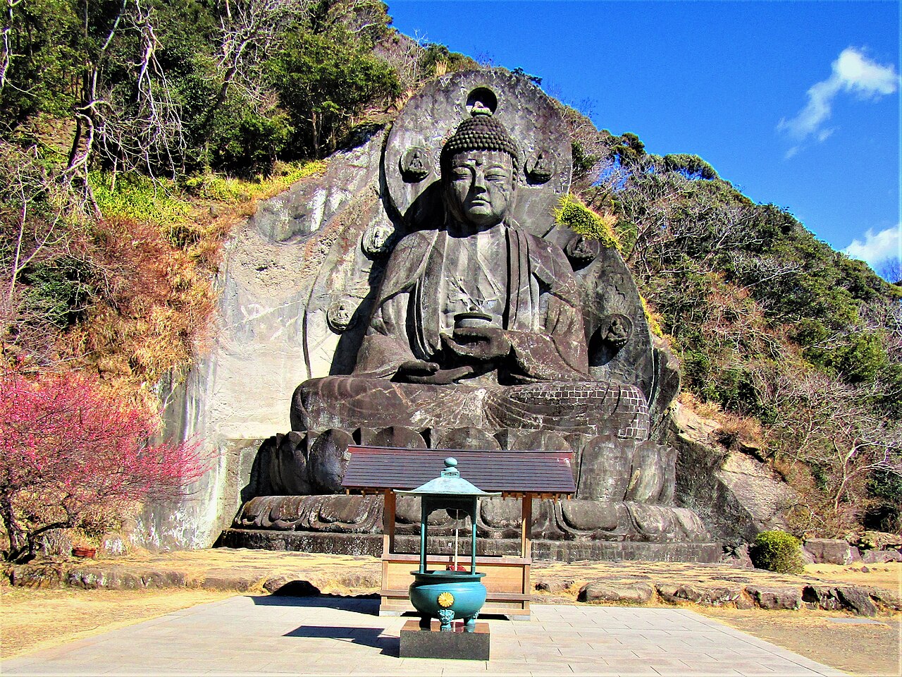
Nokogiriyama — "Saw Mountain" — rises straight from the Tokyo Bay coast in southern Chiba, its ridge cut into jagged teeth by centuries of stone quarrying. Almost the whole mountain belongs to Nihonji temple, home to Japan's largest seated stone Buddha, cliff faces carved with sacred figures, and the famous overhanging lookout called Jigoku Nozoki. This guide has the checked ropeway, temple, and ferry prices, and the route most visitors miss: arriving by boat.
A mountain made by quarrymen
For centuries Nokogiriyama was a working quarry for prized Boso building stone, and the industry left the mountain its shape: sheer, hand-cut rock walls that drop like curtains through the forest. One towering section has picked up the nickname "Laputa's Wall" for its resemblance to a floating castle's foundations. The saw-toothed silhouette that gives the mountain its name is, in truth, the tool's own signature — a landscape sculpted by the people who mined it.
The mountain straddles the border of Futtsu City and the town of Kyonan, and nearly everything above the shoreline is the precinct of Nihonji, an ancient temple whose grounds are linked by some 2,639 stone steps. Plan on real walking: this is a temple you hike.
The Great Buddha and a mountainside of carved stone
At the heart of the grounds sits the Great Buddha of Nihonji — Yakushi Nyorai, the Medicine Buddha, cradling a medicine jar. Carved from the living rock and completed in 1783 under the master carver Ono Jingorō, it stands some 31 meters tall: Japan's largest seated stone Buddha, roughly twice the height of the great bronze Buddha in Nara. Elsewhere the Hyakushaku Kannon is cut in relief directly into a quarried cliff face, and the stepped path descending from the summit area is lined with the Sengohyaku Rakan — hundreds of small stone disciples, each face different, carved by a master and his apprentices over many years. Some are headless, damage left by the anti-Buddhist movement of the Meiji era; the imperfection makes the procession more moving, not less.
From the summit lookouts — including Jigoku Nozoki, the "Peek into Hell" ledge that juts out over open air — a clear day gives you Tokyo Bay, Mount Fuji, and the Izu Peninsula in a single sweep.
Costs and hours, checked against official sources
- Ropeway (from near JR Hamakanaya Station, a short walk from the ticket gates): adults 650 yen one way, 1,200 yen round trip; children 320 / 600 yen. The ride takes about 4 minutes. Hours are 9:00–17:00 in the main season (February 16 – November 15) and 9:00–16:00 in winter. Each year around mid-January the ropeway pauses for its annual inspection, from one week to as long as a month — check before a winter visit.
- Nihonji temple entry: 700 yen for adults, paid at the gate offices.
- Tokyo Bay Ferry (Kurihama, Kanagawa ⇄ Kanaya, Chiba): about 40 minutes across the bay; adults 1,100 yen one way, 2,000 yen round trip (fares current from July 2025).
Getting there — and why the ferry is the better story
By rail, JR Uchibo Line local trains serve Hamakanaya Station at the mountain's foot; from Tokyo you change from a fast train toward Chiba/Kimitsu onto the local line down the coast. It works, but the memorable approach is by water: take the train to Kurihama on the Kanagawa side, board the Tokyo Bay Ferry, and watch the saw-toothed ridge grow across the bay for forty minutes before docking at Kanaya below it. Pairing rail one way with the ferry the other turns a plain day trip into a small voyage.
Walkers have a third option: from JR Hota Station, one stop south, the old Omotesando pilgrim approach climbs steadily to Nihonji's Ninnomon gate past the Kannondo hall and the heart-shaped Shinjiike pond — a quiet, tree-shaded entry that predates the ropeway by centuries. A sago palm along the way is said to have been planted by the twelfth-century warlord Minamoto no Yoritomo.
Where to stay
Disclosure: This post may contain affiliate links. If you book through them, we may earn a commission at no extra cost to you.
A half-day that works
- Ride the ropeway up in the morning, when the light over the bay is at its best, and do Jigoku Nozoki and the summit lookouts first.
- Descend through the Rakan path — take it slowly; the small figures reward attention more than the famous viewpoints do.
- End at the Great Buddha plaza, the flattest and calmest part of the grounds, then exit downhill.
- If your legs are willing, skip the ropeway down and walk out via the Omotesando to Hota — you will likely have the old approach almost to yourself.
When it is quiet — and when it is not
- Clear-sky weekends and autumn foliage days bring queues to the ropeway and a crowd to Jigoku Nozoki. On such days, arrive at opening time.
- Weekday mornings, even in good season, leave the Rakan path and the quarry walls nearly silent between ropeway arrivals.
- The Omotesando approach and the Great Buddha plaza stay calm even when the summit is busy — the crowd here concentrates at the famous ledge and thins fast below it.
- Summer is hot on the exposed stone; carry water and favor the forested paths in the middle of the day.
Honest notes before you go
- The mountain is stairs, almost all the way — 2,639 of them through the full grounds. Sturdy shoes matter, and knees feel the descent more than the climb.
- The temple grounds are large and one-way-ish in places; give the full circuit half a day, or use the ropeway and focus on the summit zone and Rakan path if you have less.
- In winter, confirm the ropeway inspection dates before building a day around it.
For the other side of the bay-and-mountain formula, see Enoshima, or compare every trip in this series in Quiet Day Trips from Tokyo Without a Car.
Compare options and book via our partner links: Mount Nokogiri guided hiking and day tours on GetYourGuide.